

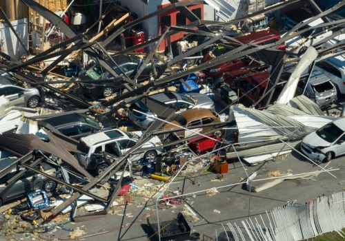
As 2026 approaches, the question isn’t if another major U.S. earthquake will strike, but where and how bad it will be. Most people still think of earthquakes as a West Coast issue that only affects Hollywood and the San Andreas Fault. But that illusion is dangerously outdated. The latest U.S. Geological Survey (USGS) models tell a much darker story: powerful quakes are possible in places far beyond California, and many Americans are living right on borrowed time without realizing it.
The unsettling truth is that millions of Americans are living closer to the next major quake zone than they realize and few are prepared for what’s coming.
Why Can’t Earthquakes Be Predicted Exactly?
According to the USGS, earthquakes can’t be predicted with precision because the processes that cause them don’t produce consistent and measurable warning signs. What scientists can do, however, is calculate probabilistic seismic hazard – the likelihood that a certain level of ground shaking will occur over time.
The 2023 National Seismic Hazard Model is the most comprehensive update in decades. It combines data from thousands of faults, ground-motion models, and historical seismicity across all 50 states.

This model doesn’t tell us when earthquakes will occur, but it does show where strong shaking is most likely in the coming decades. For anyone writing or planning around earthquakes in 2026, these maps are the best guide.
What Should You Do in Case of an Earthquake?
Important Steps to Take
Even the most seasoned preppers know there’s a world of difference between planning for disaster and being in the middle of one. So, when the ground starts to shake, quick, calm action can save your life. The U.S. Geological Survey emphasize three key steps:
- Drop immediately to your hands and knees before the shaking knocks you down.
- Cover your head and neck under a sturdy table or desk. If no shelter is nearby, use your arms and stay low next to an interior wall away from windows, mirrors, and heavy objects.
- Hold On to your shelter until the shaking stops. Also, be prepared for aftershocks, because smaller quakes can follow minutes, hours and even days later.
If you’re indoors, stay there. Avoid running outside – most injuries occur from falling debris and glass near building exteriors. If you’re in bed, stay put and protect your head with a pillow. In case you’re outside, move to an open area away from buildings, power lines, and trees. If you’re driving, slow down and pull over safely away from overpasses, bridges, and utility poles. Stay in the vehicle until the shaking ends.
After the quake, check yourself and others for injuries. If you smell gas, turn it off if possible and leave the area.
How to Stay Safe When Earthquakes Trigger Blackouts
When a major earthquake hits, one of the most immediate consequence is often a blackout. Power grids are extremely vulnerable to seismic damage. As you might know, shaking can snap transmission lines and shut down substations in an instant.
 In those first few minutes, cities can go from fully powered to completely dark. Even after the shaking stops, power restoration can take days, sometimes weeks, as crews navigate damaged roads and unstable structures to make repairs.
Massive blackouts following earthquakes have already happened, and the results were grim. In 1989, the Loma Prieta quake plunged parts of the Bay Area into darkness for days, leaving emergency crews scrambling without communications or traffic control.
The 1994 Northridge Earthquake knocked out power to millions across Southern California, sparking fires from broken gas lines and crippled infrastructure.
High Hazard States in the US
California Is Still the Nation’s Hotspot
It’s no surprise that California remains the most seismically active and studied region in the United States. The major fault systems – for instance, the San Andreas Fault, Hayward Fault and San Jacinto Fault – pose ongoing threats to millions of residents. Much of the exposure comes from the fault lines themselves, but also from dense population centers and old infrastructure. Preparing in California means planning for strong shaking and widespread infrastructure disruption.
Pacific Northwest: The Cascadia Subduction Zone
Beneath the coastal margins of Oregon and Washington lies the Cascadia Subduction Zone – a massive fault system where the Juan de Fuca Plate is sliding beneath the North American Plate. This boundary is capable of producing a magnitude 8 to 9 megathrust earthquake, an event on par with Japan’s 2011 Tōhoku disaster.
Researchers have found evidence of repeated, catastrophic ruptures along this zone, with the last major event occurring in the year 1700. Based on these findings, it’s estimated that Cascadia’s major earthquakes recur roughly every 300 to 600 years, placing the region within a plausible window for another significant event in the not-too-distant future.
Beyond severe ground shaking, the risks extend offshore: a large Cascadia rupture would almost certainly trigger a powerful tsunami capable of inundating low-lying coastal areas within minutes.
Alaska is America’s Earthquake Capital
Alaska experiences more large earthquakes than any other state, including the 1964 magnitude 9.2 “Great Alaska Earthquake”, the second largest ever recorded worldwide. Ongoing subduction of the Pacific Plate under the North American Plate keeps Alaska as a constant high-hazard region. While the population is smaller and far-flung, the logistical challenges of response and recovery in Alaska make strong preparedness absolutely vital.
The Intermountain West
States such as Nevada, Utah, Idaho, and Montana are riddled with active faults. For example, the Wasatch Fault in Utah, which runs near Salt Lake City, is of particular concern. Although less discussed in mainstream media than California, exposure here is just as real, especially for preppers who may assume they’re “safe” away from the obvious coastal zones.
Moreover, the Yellowstone supervolcano that sits beneath Wyoming, Montana, and Idaho could trigger widespread earthquakes, ash fallout, and infrastructure collapse hundreds of miles away. Even moderate seismic activity in this area can set off chains of quakes in surrounding states, far from the obvious danger zones.
The “Sleeping Giant” Zones
Stretching across southeast Missouri, northeast Arkansas, western Tennessee, and parts of Kentucky and Illinois, the New Madrid Seismic Zone (NMSZ) produced a series of massive earthquakes in 1811-1812 that were felt as far as the East Coast. While the recurrence interval is long, the consequences could be devastating, especially given soft soils and sedimentary basins that amplify shaking.
Even so, preppers in these central states must remember that rarity doesn’t mean “never”. The infrastructure here may not be built for high-magnitude shaking.
⇒ You Probably Won’t Survive An EMP Without This
Further east, the Wabash Valley Seismic Zone (southern Illinois-Indiana border) shows moderate hazard. Rare but damaging earthquakes have also occurred in states like South Carolina and Virginia, reminding the eastern USA that seismic risk isn’t exclusive to the West Coast. For preppers in these regions, the challenge is awareness, because the “quake risk” mindset is less common.
New Risks from Induced Seismicity
In the 2010s, Oklahoma surpassed California in the number of felt earthquakes. This was mostly linked to wastewater injection from oil and gas operations. Although injection volumes have since been reduced, the USGS short-term induced seismicity models still assign Oklahoma and parts of Texas and Kansas an annual probability (5-12%) of damaging shaking.
That means even in 2026, preppers should stay alert, as shifts in industrial practices can still influence seismic risk. And while most preppers in these regions already have their bases covered, earthquakes demand a different kind of preparation – the one that deals with injuries, contaminated water supplies, and medicine ruined by flood or moisture.

THIS USEFUL GUIDE fits right into that reality, offering clear guidance for treating wounds, infections, and everyday medical problems when supplies are limited. Written by physicians who’ve seen what real crisis medicine looks like, it’s a practical ally for anyone who wants to be steady in times of crisis.
What the 2023 Model Tells Us for 2026
Western states remain the epicenter of USA seismic hazard. As the updated model confirms, states such as California, Alaska, Oregon, Washington, Nevada, and Utah top the list for long-term shaking potential. Moreover, Central US zones pose rare but severe risk. The New Madrid and Wabash regions have the potential to affect multiple states simultaneously, especially given the geological conditions.
Nevertheless, induced seismicity keeps the southern plains on watch. Oklahoma, Texas, Kansas and surrounding areas have shown that human activity can sharply raise earthquake rates, a factor worth tracking through 2026. As the USGS notes: mitigation matters as much as modelling.
Final Thoughts
There’s no crystal ball for earthquakes in 2026. However, decades of research give us a clear map of where the ground is most likely to move. While we cannot say exactly where or when the next major US earthquake will strike, we do know where to prepare. In that sense, 2026 should be less about prediction and more about prevention.
You may also like:
 6 Items To Stockpile For The Upcoming US Blackout
The Only 3 Shelters You’ll Need to Survive in the Wild (VIDEO)
Do This Before the Next Big Blackout
The Only Disaster You Need to Prepare For
Read the full article here
")


